Tattered Fragments of The Map
NOW AVAILABLE: Order online for $15

Although some artists involved in the exhibition have also contributed written work, this publication is certainly not a catalogue of the show. Instead, we hope that various ideas which surfaced during our investigation and preparation, as well as a few of the people we came into contact with, could be presented here in a sort of schizophrenic, scattershot survey of mapping and its associated theoretical implications.

Introductions, Adam Katz and Brian Rosa
Interview with Denis Wood
Anthony Auerbach, The World is a Cut-up
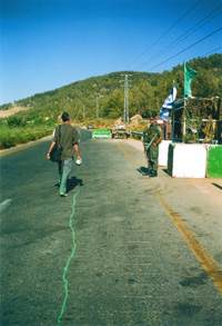
Bill Brown, Oklahoma Motel & Biosphere 2
Simone Hancox, The Map is Performed in the Territory
Elizabeth Evitts Dickinson, The Rise of The User Generated City
Bill Fox, The Angels of Mulholland drive
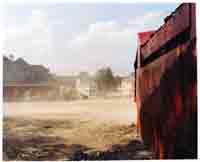
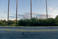
Herbert Gottfried, North Acton, Route 27 Community Gardens & Comfort Suites Under Construction, Bedford
Gerardo Greene Gondi, Image Texture
Alex Haber, Mapping the Void in Perec’s Species of Spaces
Cris Benton, A Brief History of Kite Aerial Photography
Anusha Venkataraman, Situating the Grassroots: Collectivity and Imagination

Order A Copy of the Book From Lulu

This is a no-profit venture – Purchasing a copy of Tattered Fragments helps to fund the Photocartographies project. If you would prefer, books are also available at g727 in downtown Los Angeles.

.pdf versions of the book are available for those interested in reviewing or promoting the project, contact us.

> >Contributor >Info >News >Support


Adam Katz

Adam Katz is a cultural programmer, curator and consultant based in Los Angeles. He currently acts as the program manager at Telic Arts Exchange, co-directs the artist run workspace gallery, and has recently developed innovative arts and community spaces in Venice Beach (The Mission) and Silver Lake (siteLA). Adam has consulted on a variety of public art projects and patron initiatives. In Providence, Rhode Island he helped found Building 16.

> >Curator >Exhibition >Publication


Anusha Venkataraman
Situating the Grassroots: Collectivity and Imagination

At the intersection of community organizing, artistic practice, and political movement-making has emerged a fertile ground of grassroots spatial strategies that simultaneously critique and provide an alternative to dominant forms of cultural production. Occurring on a small scale in place-specific communities, ordinary citizens, academics, and activists alike have been mapping, art-making, and change-making on a horizontal level.  How can we support grassroots movements that reclaim the public imagination? And what utopian images have emerged to map the political and social ideals of the future?

Anusha Venkataraman is based in Brooklyn, NY. Her work focuses on engaged artistic practices as tools for community development.  She has  worked with artist collectives in Providence, RI and Brooklyn on participatory urban interventions.

Contributor >Publication


Cris Benton
Pacific Beach and a Brief History of Kite Aerial Photography

Benton is a Professor of Architecture and former department chair at UC Berkeley. He harbors considerable passion for Kite Aerial Photography (KAP) and its associated historical, applied, and artistic dimensions. Benton takes his photographs using relatively simple handmade equipment. The camera is positioned by walking the kite around and aimed using a homebuilt, radio-controlled cradle. Composition is accomplished in absentia as he imagines what the camera above would see. “Kite aerial photography appeals to that part of me, perhaps of all of us, that would slip our earthly bonds and see the world from new heights. An aerial view offers a fresh perspective of familiar landscapes and in doing so challenges our spatial sensibilities, our grasp of relationships.”(hidden ecologies)

> >Artists >Exhibition >Publication


Bill Brown

Bill Brown is a “nomadic” filmmaker, photographer, and author from Lubbock, Texas. He has produced films on the United States–Mexico border, North Dakota missile silos, the Trans-Canada Highway, among other places. The films have been exhibited at numerous film festivals and museums, including the Museum of Modern Art in New York. He describes his films as postcards with a pretty picture but instead of words on the back, his films are narrated with voiceover. He’s also the author of a zine called Dream Whip which currently has 14 issues, and the book Saugus to the Sea. (dreamwhip zine)

> >Contributor >Publication


Gerardo Greene Gondi
Image Texture

Seeing a photograph we are seeing a landscape. The image texture opens for us a sight of something, thus discovering and revealing a particular image of the world. There is always a certain type of illusion in the act of seeing a picture. We can see the world by ways of its possible images, and at the same time we can give meaning to what we see through what these possible images tell us about the world.

Gerardo Greene Gondi is a photographer and PhD candidate in philosophy at the Universidad Nacional Autónoma de México (UNAM), Mexico City.  His research addresses phenomenology and photography.

> >Contributor >Publication


Alex Haber
Mapping the Void in Perec’s Species of Spaces

Species of Spaces, by Georges Perec, is a curious book.  Not quite a collection of poetry, not quite a collection of essays, it attempts to define, catalog, and generally shed light on the different layers of spaces that permeate our everyday lives.  Perec’s epigraph, the “Map of the Ocean” from Lewis Carroll’s “The Hunting of the Snark,” provides an important lens through which to view this text.  This is no traditional map, however: rather than lines, points, or recognizable geographic features, this map is nothing more than a space of blank page delineated from the rest of the blank page by a thin black line and a caption. 

Haber is a scholar of comparative literature whose research interests include literary constraint, the city, and theories of selfhood in nineteenth and twentieth century French literature and thought.

> >Contributor >Publication


Simone Hancox
The Map is Performed on the Territory

Both photography and cartography have naturalised themselves as ‘mirrors’ to reality under the auspice of their representational realism. Yet, behind the temporally static, spatially delimited and two-dimensional image, there is a gaze involved in its inception that alludes to a presentness of ongoing social and cultural reconfigurations. Drawing on theories of politics and aesthetics, I explore the power at play within this gaze. In doing so I question the extent to which it may be reconceived as a doubly performative act (performed first by the ‘author’ and then ‘viewer’) that creates the potential for political agency rather than a dynamic that seemingly renders one party (the viewer) as passive.

Simone Hancox is a PhD student in the Department of Drama at Queen Mary, University of London.  Her research interests include performance  and the city, walking as an aesthetic practice, urban interventions and live art.

> >Contributor >Publication


Herbert Gottfried
Excerpts from 42 30 North

Lines of latitude rarely impinge on our everyday experience. Most of us recognize them as a set of east-west lines on a map, coordinated with lines of longitude to create a spatial system useful in ascertaining locations. The lines have a history of application in cartography, and an equally rich record of use in the affairs of societies preoccupied with discovery, enterprise, empire, war and the occasional human folly. Today, a line of latitude or longitude can be seen as a tool with which to document a cultural landscape and its environmental systems. A Line on the Land: 42.30N and the Massachusetts Landscape is that kind of project–a collaboration by Frank Gohlke, a photographer, and Herbert Gottfried, a poet, to recreate a line across a state. One minute of latitude is a mile wide on the ground, thus 42.30N is 1 mile by 155 miles of landscape, from the Marblehead Neck on the east to Berry Mountain on the west. We drove, walked, and even paddled across Massachusetts using a hand-held GPS device to locate the latitude. Once in the line, we explored that mile, responding independently to what we found. Our intent was to make the abstraction real by juxtaposing the image and poem across the land.

Herbert Gottfried is a poet and Pofessor Emeritus in the Department of Landscape Architecture at Cornell University, where he cunducts cultural landscape studies.

> >Contributor >Publication


Elizabeth Evitts Dickinson
The Rise of the User Generated City

Maps are often taken as reality, as objective presentations of fact, but anyone studying cartography recognizes maps as a relatively subjective form. They are communication tools rooted in culture and history and how we understand territory depends on our perspective. Interpretation, bias, and circumstance play a large role. This article explores a series of questions arising out of the unprecedented access to mapping technologies. What impact does user generated mapping have on our perception of cities and space? Will access to photocartography, like Google Earth, bias our understanding of what a particular geography can achieve? Or will the various filters, the many different perspectives, open us up to new possibilities? What happens when we become the cartographers of our own lives?

Elizabeth Evitts Dickinson is a Baltimore-based writer who covers architecture, design, urban planning, and culture for publications like The New York Times Magazine, Metropolis, and Architect.  (Urban Palimpsest blog).

> >Contributor >Publication
Bill Fox
An excerpt from Aereality: Essays on the World from Above

William Fox’s writing for the last several years has been focused on how we construct aerial views, either physically (by flying) or in our imaginations. In Aereality, he flies over earthworks in Nevada and Utah, soars through the world’s largest open pit mine, and surveys Los Angeles, circumnavigating large swaths of true American urban sprawl. On the East Coast, he examines the elevated art of the Hudson River Valley and New York City. And finally, in Australia, Fox examines the history and current practice of both Euro-Australian and Aboriginal aerial views, and searches for the cognitive roots of our aerial imagination. Accompanying Fox throughout his travels is a rolling cast of enlightened fliers: geographers, museum curators, landscape photographers, anthropologists, and artists. He traverses the sky in prop planes, helicopters, and hot air balloons, all with the ultimate goal of knowing and experiencing the earth from the air.

> >Contributor >Publication


Anthony Auerbach
The State of New York and The World is a Cut-Up

Anthony Auerbach is an artist out of London, working in different places. He is also active as a theorist. His (photo)cartographic interests stem from a preoccupation with drawing, hence with surfaces: marks, traces, inscriptions, and erasure of the same.

The State of New York is an aerial survey of the whole state of New York from an altitude of seven feet. The survey records the surface of a giant copy of the Texaco road map which was inlaid in the terrazzo floor of the New York State Pavilion for the 1964–65 World’s Fair. The pavilion, designed by Philip Johnson and advertised as the ‘Tent of Tomorrow’, now stands derelict in Flushing Meadows Corona Park, Queens. (aauerbach.info)

> >Artists >Exhibition >Publication


Brian Rosa


Brian Rosa is an urban researcher, photographer, and curator.  Originally from New Haven, CT, and most recently based in Mexico City, he is beginning a PhD in human geography at The University of Manchester (UK).  He is currently living in Manchester.  (brianrosa.net)

> >Curator >Exhibition >Publication