Announcement: Travelogue
Films by Bill Brown and a video installation by Bia Gayotto
May 22 at 7:00pm

Hosted at g727, 727 S. Spring St. in downtown LA
All welcome, $mall donation, popcorn and beer…

Bill Brown

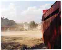
Confederation Park (1999), The Other Side (2006), Mountain State (2003)
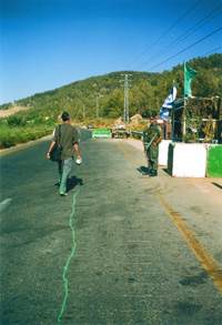
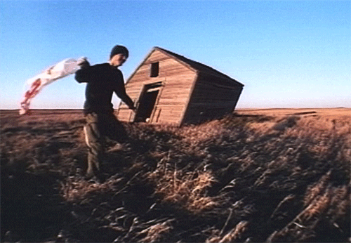
Bill Brown is a “nomadic” filmmaker, photographer, and author from Lubbock, Texas. He has produced films on the United States–Mexico border, North Dakota missile silos, the Trans-Canada Highway, among other places. The films have been exhibited at numerous film festivals and museums, including the Museum of Modern Art in New York. He describes his films as postcards with a pretty picture but instead of words on the back, his films are narrated with voiceover.

Bia Gayotto
Xing LA: From Altadena to Long Beach (2008)

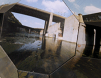
Xing LA is an investigation of the mobile space of the commute, exploring three parallel routes by foot, by train, and by car. From “footslogging” to modern modes of transportation, the travelogue provides a portrait of Los Angeles, examining how the route and the experience of the route change depending on the mode of travel.

> >Events >News


Announcement: Photocartographies Exhibition at g727

Opening Reception, May 16 at 7:00pm
727 south spring street
downtown los angeles, ca 90014
http://g727.org
May 16-June 30, Fri/Sat 1-6

The artwork collected in this exhibition is a survey of diverse perspectives projected along the horizon of our mappable world. The geography created by these artists is not only physical, but psycho-social. Although much of the work employs photography, there is a welcome uncertainty in these images-objects which reflect the shifting, contested and mysterious nature of our current cultural, environmental and built landscapes.

Presenting Anthony Auerbach, Katherine E. Bash, Noah Beil, Cris Benton, Frank Gohlke, Gregory Michael Hernandez, David Horvitz, David Maisel, Adam Ryder, Nikolas Schiller, Oraib Toukan, and Angie Waller.

> >Events >Exhibition >Info


Shaping LA, Panel Discussion
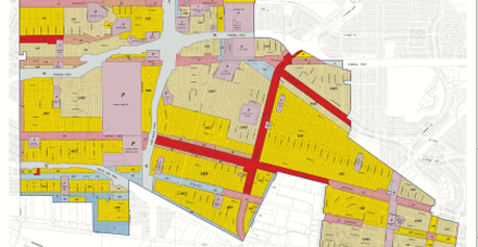
Maps for Planning, Developing and Resisting the city
June 23

Join us for a panel discussion with Meredith Drake, Liz Falletta, Lewis MacAdams and Andrew Montealegre – moderated by James Rojas.

“While most people use maps for directions, all our activity – where we work, play, eat – are color coded on a zoning map which describes where these daily performances can legally take place. However, the general public rarely sees these life shaping maps because they really don’t care. The vast majorities of people view their home, lifestyle, and mobility patterns as choices rather than something predetermined or conditioned.”

> >Events >News


Tattered Fragments of The Map
NOW AVAILABLE: Order online for $15

Although some artists involved in the exhibition have also contributed written work, this publication is certainly not a catalogue of the show. Instead, we hope that various ideas which surfaced during our investigation and preparation, as well as a few of the people we came into contact with, could be presented here in a sort of schizophrenic, scattershot survey of mapping and its associated theoretical implications.

Introductions, Adam Katz and Brian Rosa
Interview with Denis Wood
Anthony Auerbach, The World is a Cut-up
Bill Brown, Oklahoma Motel & Biosphere 2
Simone Hancox, The Map is Performed in the Territory
Elizabeth Evitts Dickinson, The Rise of The User Generated City
Bill Fox, The Angels of Mulholland drive
Herbert Gottfried, North Acton, Route 27 Community Gardens & Comfort Suites Under Construction, Bedford
Gerardo Greene Gondi, Image Texture
Alex Haber, Mapping the Void in Perec’s Species of Spaces
Cris Benton, A Brief History of Kite Aerial Photography
Anusha Venkataraman, Situating the Grassroots: Collectivity and Imagination

Order A Copy of the Book From Lulu

This is a no-profit venture – Purchasing a copy of Tattered Fragments helps to fund the Photocartographies project. If you would prefer, books are also available at g727 in downtown Los Angeles.

.pdf versions of the book are available for those interested in reviewing or promoting the project, contact us.

> >Contributor >Info >News >Support


Adam Katz

Adam Katz is a cultural programmer, curator and consultant based in Los Angeles. He currently acts as the program manager at Telic Arts Exchange, co-directs the artist run workspace gallery, and has recently developed innovative arts and community spaces in Venice Beach (The Mission) and Silver Lake (siteLA). Adam has consulted on a variety of public art projects and patron initiatives. In Providence, Rhode Island he helped found Building 16.

> >Curator >Exhibition >Publication


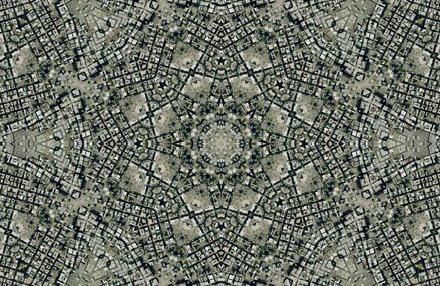
ARABESQUE AERIAL PHOTOGRAPHY BY NIKOLAS SCHILLER – $250
Los Angeles Fashion District Quilt

This piece was created for the Photocartographies project to include Los Angeles’ Fashion District and g727.

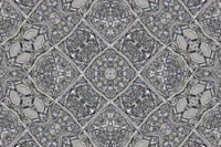
Schiller’s prints are highly detailed tesselations of USGS imagery. More information about his Los Angeles images can be found on his website at nikolasschiller.com

> >Commemorative Artwork


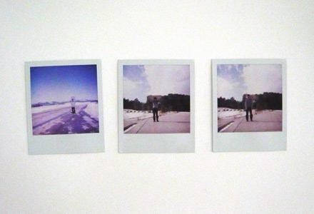
POLAROIDS BY DAVID HORVITZ – SOLD
Polaroid of David standing directly in front of Devil’s Tower
Polaroid of David standing directly in front of Mt. Rushmore (you can see Mt. Rushmore)
Polaroid of David standing in same position with his jacket obscuring all of Mt. Rushmore

-the two mt. rushmores can be the piece b/c they kind of go together
-or one devil and one rushmore
-or one devil and two rushmores together as one

Polaroids will be matted and placed behind glass in a white lacquer frame, depending on how many you want and what you want to do with them.

> >Commemorative Artwork


PHOTOGRAPH BY NOAH BEIL – SOLD
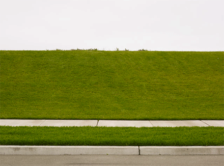
Oakland, California (20080511, 09:32:37, 37.806410N 122.323800W)

This print sold in a white lacquer frame, signed on reverse. Approximately 16″ x 10″.

From the series, Berms and Drumlins: “By examining mankind’s reshaping of the earth, I explore how we assign positive and negative values to anthropogenic landscape modifications. As human inhabitants of the earth, we are bound to affect the environment. How do we determine whether our modifications have a positive or negative impact on the landscape?”

> >Commemorative Artwork


Sticky: SALE: EDITIONED ARTWORK
Commemorative Pieces – all sales benefit this no-profit project

Participating artists have donated editioned work to help raise money for the Photocartograpaphies project. Prices vary but are all under $300.

Pick up recent works by Anthony Auerbach, Charles Benton, Adam Ryder, Noah Beil, David Horvitz, and Gregory Michael Hernandez.

View available works.
Arrange sales / inquiries.

> >Commemorative Artwork >Exhibition >News >Support


PHOTOGRAPH BY ANTHONY AUERBACH – $250
Untitled

A single archival photographic print, approximately 9×13″, sold in a white lacquer frame.

This piece belongs to a project executed at Hopper’s warehouse on Fletcher drive during the artist’s recent visit to LA. The work in fact consists of the drawing (pictured) and a very long video recording.

> >Commemorative Artwork


PHOTOCOLLAGES BY GREGORY MICHAEL HERNANDEZ – $250 each
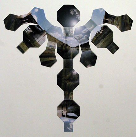
Confluence of the LA River and Arroyo Seco (#1-9)

These large photo-collages are part of a 9 piece series, each unique, sold unframed. Signed by the artist. Approximately 34″ x 28″, constructed from 26 hand cut c-prints on paper.

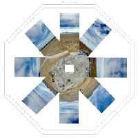
Each is a different and unique (two-dimensional) arrangement of the 26 shapes that comprise the truncated cuboctahedron. If assembled, each becomes the same three-dimensional object, representing the entire realm of vision. The 10 different arrangements reflect the nature of the river; it has been shaped and changed over the years according to different perspectives and choices, and debates still persist over the proper function and future of the rivers. The river used to provide simple sustenance to Native Americans, and some of my aesthetic choices in the arrangements are reminiscent of figures or animals.

> >Commemorative Artwork


PHOTOGRAPHS BY CRIS BENTON – $250 each
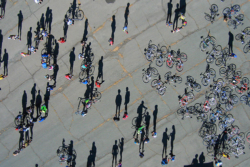
After Race, Dragor Streetscape and Crystallization Pond

Archival digital prints, matted and placed in white lacquer frames behind non-glare plexiglass. Each image is about 9″ x 12″ on 12″ x 16″  paper, signed by the artist.

These photographs were taken from a custom built kite with a remote controlled camera rig. For more information visit Cris’ old website or his hidden ecologies site.

> >Commemorative Artwork


Frank Gohlke
42 30 North

Frank Gohlke was born in Wichita Falls, Texas, in 1942.  He began taking photographs in dead earnest in 1967, when his plans for a career teaching English Literature foundered on the rocky shoals of a massive writer’s block.  He has been fortunate enough to be able to keep photography at the center of a life whose richness includes three daughters, two grandchildren, and many wonderful friends.  He has primarily been a photographer of landscapes, but that could always change.

42 30 North is a collaboration between a photographer, Frank Gohlke, and a poet and landscape historian, Herbert Gottfried.  It is a survey of the land within a single line of latitude, Forty two degrees Thirty minutes North, from the Atlantic Ocean at Marblehead, Massachusetts, to the Massachusetts-New York state boundary, a strip approximately one mile wide by 165 miles long.  The project makes no pretense of exhaustiveness, celebrating instead the arbitrariness of boundaries and the centrality of imagination in transforming terrain into place.  (frankgohlke.com)

> >Artists >Exhibition


DIGITAL COMPOSITE BY ADAM RYDER – $250
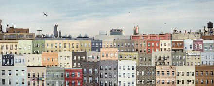
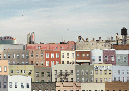
Brooklyn

Ink-jet print of a digital collage, approximately 20″ x 8″. Sold in a white lacquer frame with non-glare plexiglass.

> >Commemorative Artwork


David Maisel

David Maisel, a visual artist and photographer, chronicles the tensions between nature and culture in his large-scaled photographs of worlds that hover between the visible and the invisible, the natural and unnatural, the sacred and the profane. Maisel’s practice is concerned with mining the visual territory of what he terms the “apocalyptic sublime,” and with addressing themes of loss, elegy, and memorialization. He is perhaps best known for his large-scaled photographs in Black Maps, a multi-chaptered series of abstracted aerial images of environmentally impacted sites, such as open pit mines, clear cut forests, and cyanide leaching fields.

Maisel’s photographs are in the collections of the Metropolitan Museum of Art, the Los Angeles County Museum of Art, the Brooklyn Museum of Art, the Houston Museum of Fine Arts, and many others. Maisel was a Visiting Scholar at the Getty Research Institute in Fall 2007, and an Artist in Residence at the Headlands Center for the Arts in Spring 2008. David Maisel’s work is represented by the Haines Gallery in San Francisco and the Von Lintel Gallery in New York. (davidmaisel.com)

> >Artists >Exhibition


Anusha Venkataraman
Situating the Grassroots: Collectivity and Imagination

At the intersection of community organizing, artistic practice, and political movement-making has emerged a fertile ground of grassroots spatial strategies that simultaneously critique and provide an alternative to dominant forms of cultural production. Occurring on a small scale in place-specific communities, ordinary citizens, academics, and activists alike have been mapping, art-making, and change-making on a horizontal level.  How can we support grassroots movements that reclaim the public imagination? And what utopian images have emerged to map the political and social ideals of the future?

Anusha Venkataraman is based in Brooklyn, NY. Her work focuses on engaged artistic practices as tools for community development.  She has  worked with artist collectives in Providence, RI and Brooklyn on participatory urban interventions.

Contributor >Publication


Nikolas Schiller
Los Angeles Freeway Interchanges

Schiller’s satellite mashups confront many of the power dynamics inherent in maps and manifest in our impulse to claim, know and control space. In addition to his kaleidoscopic “quilts” for major American cities, Schiller has fractured and fused contested borders, sites of environmental tragedy and political conflict. In his series of Los Angeles freeway interchanges, the disorientation of automotive navigation is heightened in images that enfold our familiar corridors and boundaries.

Nikolas Schiller is a 28-year-old cartographer, consultant, digital artist, photographer, activist, and blogger living in America’s last continental colony, Washington, DC. (nikolasschiller.com)

> >Artists >Exhibition


Cris Benton
Pacific Beach and a Brief History of Kite Aerial Photography

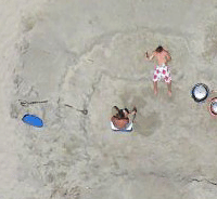
Benton is a Professor of Architecture and former department chair at UC Berkeley. He harbors considerable passion for Kite Aerial Photography (KAP) and its associated historical, applied, and artistic dimensions. Benton takes his photographs using relatively simple handmade equipment. The camera is positioned by walking the kite around and aimed using a homebuilt, radio-controlled cradle. Composition is accomplished in absentia as he imagines what the camera above would see. “Kite aerial photography appeals to that part of me, perhaps of all of us, that would slip our earthly bonds and see the world from new heights. An aerial view offers a fresh perspective of familiar landscapes and in doing so challenges our spatial sensibilities, our grasp of relationships.”(hidden ecologies)

> >Artists >Exhibition >Publication


Bill Brown

Bill Brown is a “nomadic” filmmaker, photographer, and author from Lubbock, Texas. He has produced films on the United States–Mexico border, North Dakota missile silos, the Trans-Canada Highway, among other places. The films have been exhibited at numerous film festivals and museums, including the Museum of Modern Art in New York. He describes his films as postcards with a pretty picture but instead of words on the back, his films are narrated with voiceover. He’s also the author of a zine called Dream Whip which currently has 14 issues, and the book Saugus to the Sea. (dreamwhip zine)

> >Contributor >Publication


enGage ludiCity
A Situationist-inspired ludic urban action with UCLA’s REMAP
personal distruptive ludiC Actions: June 13 to June 19
collective situationist ludiC enGagement: June 20

Saturday June 20 at g727
Daylight Engagement: 4pm to 6:30pm
Night Engagement: 9:30pm to 12midnight

enGage ludiCity is a Situationist-inspired ludic urban action (detournement / derive) using mobile technology for collective design and reflection on the psychogeography and historicity of Los Angeles. A Cultural Civic Computing experience by UCLA’s Center for Research in Engineering Media and Performance (REMAP).

For more information, visit la.remap.ucla.edu/ludicity.

The term “ludic” refers to any situation or activity relating to play or playfulness. As was the case for the Situationist International movement, playfulness is a key component of this project. Participants are invited to explore the city as a “ludic space” and to experience the city through “ludic actions”. The intention is to disrupt capitalist psychogeographic tendencies and promote new ways of seeing and thinking the city.

For one week leading up to the collective engagment (June 13-20), participants will generate information about the city by logging locations and actions with their phones using text messages. On June 20th everyone is invited to explore downtown LA using new maps created from this accumulated information.

The process is structured in 3 stages:

    A) Personal Disruptive Ludic Actions (ludus constituo)
    + Participants create and register a Fictitious Identity at http://la.remap.ucla.edu/ludicity/createuser.php
    + The enGage ludiCity Situationist Messaging System (sms) sends random ludic action requests to each participant’s cell phones. Participants send feedback on the performed/completed actions.
    + Through their ludic actions and feedback the evolving Situationist Ludic Map at la.remap.ucla.edu/ludicity/actionmap is created by the participants.

    B) Collective Situationist Ludic Engagement (ludis locus)
    + Participants gather to explore downtown using the collectively-created Situationist Ludic Map and sets of Situationist Dérive Instructions generated from the ludic actions feedback.
    + As they explore downtown participants engage in repurposing and transformative activities (detournement).
    + Participants are equipped with mobile technology to generate automatic documentation (paths, sounds, images) of their Situationist experience.

    C) Reflexive Situationist Dialogue (ludis meditor)
    + Participants and others will be able to access all of the materials generated in the first two stages, comment and dialogue about them.

We hope you will join us for all three stages of the experimental process. But you can choose any combination that fit your schedule and interest. We do ask you to please register using the form at http://la.remap.ucla.edu/ludicity/createuser.php.

REMAP
The Center for Research in Engineering, Media and Performance is a joint effort of the UCLA School of Theater, Film and Television and Henry Samueli School of Engineering and Applied Science. REMAP bridges the world-class faculty and students of HSSEAS and TFT to explore new enriching cultural forms and empowering social situations enabled by the thoughtful interweaving of engineering, the arts and community development.

“In a dérive one or more persons during a certain period drop their relations, their work and leisure activities, and all their other usual motives for movement and action, and let themselves be drawn by the attractions of the terrain and the encounters they find there. Chance is a less important factor in this activity than one might think: from a dérive point of view cities have psychogeographical contours, with constant currents, fixed points and vortexes that strongly discourage entry into or exit from certain zones.” (From Guy Debord’s Theory of the Dérive)
> >Events >News


Angie Waller
The Most Boring Places in the World

Angie Waller is a New York based artist who uses her online presence, couchprojects, to document a compelling set of cultural interventions in commercialism, shopping and social networking. Waller’s research-based art projects use the information collected from various online sources to form impressionistic, systematic visualizations (videos, photos, books, images, charts), which offer disarming perspectives on the everyday. (couchprojects.com)

> >Artists >Exhibition


Oraib Toukan
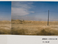
Trans-Jordan

“How much are terrains manipulated to become symbols of nostalgic elements of being and belonging. Amman has lived off the fantastical visual idioms that come with the sound of the words ‘Beirut’, ‘Damascus’, ‘Baghdad’, or ‘Haifa’. The names of these cities become a mise en abyme in that their is infinity in a word.” (oraibtoukan.com)

> >Artists >Exhibition


David Horvitz
New York to Reykjavik

David Horvitz was born in Los Angeles and currently lives in Brooklyn, NY. His art practice uses an array of forms: photography, video, web-work, writing, and mail-art.  For photocartographies Horvitz is exhibiting a photograph shot in Iceland on one of the artist’s travels. Displayed with the photographs are documents of every means of transportation required to get from his home in New York to a small island in Reykjavik.(davidhorvitz.com)

> >Artists >Exhibition


Gerardo Greene Gondi
Image Texture

Seeing a photograph we are seeing a landscape. The image texture opens for us a sight of something, thus discovering and revealing a particular image of the world. There is always a certain type of illusion in the act of seeing a picture. We can see the world by ways of its possible images, and at the same time we can give meaning to what we see through what these possible images tell us about the world.

Gerardo Greene Gondi is a photographer and PhD candidate in philosophy at the Universidad Nacional Autónoma de México (UNAM), Mexico City.  His research addresses phenomenology and photography.

> >Contributor >Publication


Alex Haber
Mapping the Void in Perec’s Species of Spaces

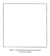
Species of Spaces, by Georges Perec, is a curious book.  Not quite a collection of poetry, not quite a collection of essays, it attempts to define, catalog, and generally shed light on the different layers of spaces that permeate our everyday lives.  Perec’s epigraph, the “Map of the Ocean” from Lewis Carroll’s “The Hunting of the Snark,” provides an important lens through which to view this text.  This is no traditional map, however: rather than lines, points, or recognizable geographic features, this map is nothing more than a space of blank page delineated from the rest of the blank page by a thin black line and a caption. 

Haber is a scholar of comparative literature whose research interests include literary constraint, the city, and theories of selfhood in nineteenth and twentieth century French literature and thought.

> >Contributor >Publication


Simone Hancox
The Map is Performed on the Territory

Both photography and cartography have naturalised themselves as ‘mirrors’ to reality under the auspice of their representational realism. Yet, behind the temporally static, spatially delimited and two-dimensional image, there is a gaze involved in its inception that alludes to a presentness of ongoing social and cultural reconfigurations. Drawing on theories of politics and aesthetics, I explore the power at play within this gaze. In doing so I question the extent to which it may be reconceived as a doubly performative act (performed first by the ‘author’ and then ‘viewer’) that creates the potential for political agency rather than a dynamic that seemingly renders one party (the viewer) as passive.

Simone Hancox is a PhD student in the Department of Drama at Queen Mary, University of London.  Her research interests include performance  and the city, walking as an aesthetic practice, urban interventions and live art.

> >Contributor >Publication


Herbert Gottfried
Excerpts from 42 30 North

Lines of latitude rarely impinge on our everyday experience. Most of us recognize them as a set of east-west lines on a map, coordinated with lines of longitude to create a spatial system useful in ascertaining locations. The lines have a history of application in cartography, and an equally rich record of use in the affairs of societies preoccupied with discovery, enterprise, empire, war and the occasional human folly. Today, a line of latitude or longitude can be seen as a tool with which to document a cultural landscape and its environmental systems. A Line on the Land: 42.30N and the Massachusetts Landscape is that kind of project–a collaboration by Frank Gohlke, a photographer, and Herbert Gottfried, a poet, to recreate a line across a state. One minute of latitude is a mile wide on the ground, thus 42.30N is 1 mile by 155 miles of landscape, from the Marblehead Neck on the east to Berry Mountain on the west. We drove, walked, and even paddled across Massachusetts using a hand-held GPS device to locate the latitude. Once in the line, we explored that mile, responding independently to what we found. Our intent was to make the abstraction real by juxtaposing the image and poem across the land.

Herbert Gottfried is a poet and Pofessor Emeritus in the Department of Landscape Architecture at Cornell University, where he cunducts cultural landscape studies.

> >Contributor >Publication


Elizabeth Evitts Dickinson
The Rise of the User Generated City

Maps are often taken as reality, as objective presentations of fact, but anyone studying cartography recognizes maps as a relatively subjective form. They are communication tools rooted in culture and history and how we understand territory depends on our perspective. Interpretation, bias, and circumstance play a large role. This article explores a series of questions arising out of the unprecedented access to mapping technologies. What impact does user generated mapping have on our perception of cities and space? Will access to photocartography, like Google Earth, bias our understanding of what a particular geography can achieve? Or will the various filters, the many different perspectives, open us up to new possibilities? What happens when we become the cartographers of our own lives?

Elizabeth Evitts Dickinson is a Baltimore-based writer who covers architecture, design, urban planning, and culture for publications like The New York Times Magazine, Metropolis, and Architect.  (Urban Palimpsest blog).

> >Contributor >Publication
Bill Fox
An excerpt from Aereality: Essays on the World from Above

William Fox’s writing for the last several years has been focused on how we construct aerial views, either physically (by flying) or in our imaginations. In Aereality, he flies over earthworks in Nevada and Utah, soars through the world’s largest open pit mine, and surveys Los Angeles, circumnavigating large swaths of true American urban sprawl. On the East Coast, he examines the elevated art of the Hudson River Valley and New York City. And finally, in Australia, Fox examines the history and current practice of both Euro-Australian and Aboriginal aerial views, and searches for the cognitive roots of our aerial imagination. Accompanying Fox throughout his travels is a rolling cast of enlightened fliers: geographers, museum curators, landscape photographers, anthropologists, and artists. He traverses the sky in prop planes, helicopters, and hot air balloons, all with the ultimate goal of knowing and experiencing the earth from the air.

> >Contributor >Publication


Opening May 16, 7-10
Gallery, Friday+Saturday 1-6
727 south spring street
downtown los angeles, ca 90014


g727 seeks to generate dialogues on artistic representations and interpretations of the urban landscape. The building blocks of a city comprise more than simply buildings, streets, and sidewalks. They equally encompass personal experience, collective memory and narratives. These are the less tangible, but no less integral elements that transform mere infrastructure into place. Through photography, painting, writing and video installations, artists open our eyes to these elements and heighten our awareness of what makes a place a place. g727 welcomes these artists to its space to help us all better understand the complex nature of cities and the urban condition. (recent g727 interview)

> >Events >Exhibition >Info


Gregory Michael Hernandez

Much of Hernandez’s work confronts spaces of holy significance and geometric precision. This reveals a converging aesthetic that will be familiar to anyone who has visited a church or temple, a graveyard or a museum, a barren desert or a civic center. His images/objects feign a cartographic process, but one where the assumptions of authority are tested. Objective realities proposed by both maps and photographs are similarly confusing, although pulling in opposite directions. The traditional operation of a photograph presents the viewer with a singular subjectivity, that of the apparatus, the location of the camera. Conversely, a geographic map suggests that in the terrain represented, “you are here” or “here” or “here.” On one you cannot ever locate yourself in the projected image, and in the other you cannot help but “find yourself” in its representation. It is only human that we desire to have our “perspective” understood, respected and seen by others. To achieve this exchange with greater accuracy has long been the goal of man and machine. Hernandez approaches, with beautiful futility, a universe that has no math, no map, no image and no place from which one can really take it all in. (exilechild.com)

> >Artists >Exhibition


Adam Ryder
Recombinant Landscape

Adam Ryder is an MFA candidate in the Photography, Video and Related Media at the School of Visual Arts in New York.  In his work, he utilizes the unique language of photographic and digital imaging technologies to explore the myriad ways in which architecture, infrastructure, and development shape our lives.  His piece in Photocartographies combines elements from one hundred and fifty publicly availably aerial photographs from around the country via the United States Geological Survey.  Ryder showcases how the imposition of formal-rational systems on the landscape have created interchangeable spaces, capable of being assembled like so many blocks into a new, simulacral form resembling the agrarian interior of the country. (adamryder.com)

> >Artists >Exhibition
Thank You to all our Supporters

Sarah Anderson
Dan Caroselli
Sean Dockray
Mark Farina
Luke Fischbeck
ForYourArt
Butchy Fuego
Norman and Pepita Katz
Mia Locks
Mike Metzger
Adrian Rivas
James Rojas
Julia Sherman
Cybelle Tondu
Jessica Wang
Fiona Whitton
Denis Wood
Kelly Zinser

Get on this list by donating…

> >Patron >Support


Anthony Auerbach
The State of New York and The World is a Cut-Up

Anthony Auerbach is an artist out of London, working in different places. He is also active as a theorist. His (photo)cartographic interests stem from a preoccupation with drawing, hence with surfaces: marks, traces, inscriptions, and erasure of the same.

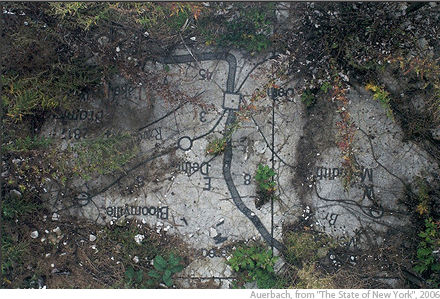
The State of New York is an aerial survey of the whole state of New York from an altitude of seven feet. The survey records the surface of a giant copy of the Texaco road map which was inlaid in the terrazzo floor of the New York State Pavilion for the 1964–65 World’s Fair. The pavilion, designed by Philip Johnson and advertised as the ‘Tent of Tomorrow’, now stands derelict in Flushing Meadows Corona Park, Queens. (aauerbach.info)

> >Artists >Exhibition >Publication


Katherine Bash
Floating Point Operation

“At the far end of the Bonneville Speedway stands the mountain known as Floating Island–”floating” because it appears to arise from water, and “island” because it is separated from other elevated landscape features by accumulated silts — feet deep (the Bonneville Salt Flat). The idea of using Floating Island as a geographical referent in mental maps made by people visiting the area is somewhat ironic. Most of the mountain is underground, and what rises 1200 feet above the playa is often indistinguishable from the mountains behind it.”

Bash is founder and Principal Investigator at the Itinerant Laboratory for Perceptual Inquiry. Her ongoing project, A Field Guide to Observable Phenomena, manifests her engagement with imaging, imagining, language, and experience of place as both creative analysis and critical practice. (katherinebash.com & itinerantlaboratory.org)

> >Artists >Exhibition


Noah Beil
Mountain as Monument

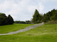
The intense bombing of World War II left the streets of many European cities clogged with the remains of demolished masonry buildings. In Berlin alone, over 45 million cubic meters of debris was cleared during post-war rebuilding efforts. After intact bricks were recovered for reuse, with much of the manual labor performed by women, waste materials were transported to distributed collection locations and piled into hills known in German as Schuttberg or Trümmerberg. Today, these debris hills are difficult to distinguish from naturally occurring features as they have been landscaped into parks with manicured grass and densely vegetated sections.

Noah Beil is an Oakland, California based photographer who interprets history by examining the landscape.(www.noahbeil.com)

> >Artists >Exhibition


Brian Rosa


Brian Rosa is an urban researcher, photographer, and curator.  Originally from New Haven, CT, and most recently based in Mexico City, he is beginning a PhD in human geography at The University of Manchester (UK).  He is currently living in Manchester.  (brianrosa.net)

> >Curator >Exhibition >Publication